
BASE MAP
(LOW ) (HIGH) (PDF)

HOUSING HISTORY
(LOW ) (HIGH)


TRANSPORTATION HISTORICAL & CULTURAL SITES WATER SYSTEMS
(LOW ) (HIGH) (PDF) (LOW ) (HIGH) (PDF) (LOW ) (HIGH)
12 Maps of Whitefield
by
Paul Hoffman
at The Sheepscot Valley Conservation
Association,
through its GIS (Geographic Information System) Support Center.
click on the resolution
(LOW ), (HIGH), (PDF) you would like to see or download.
Keep in mind some of these files are HUGE for quality prints..
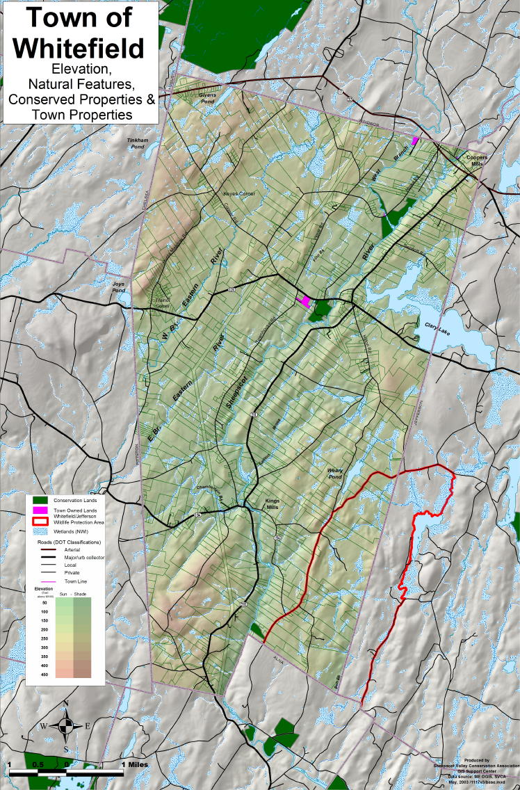
BASE MAP
(LOW
) (HIGH)
(PDF)
HOUSING HISTORY
(LOW
) (HIGH)
TRANSPORTATION
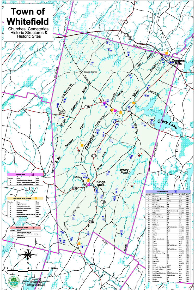
HISTORICAL & CULTURAL
SITES
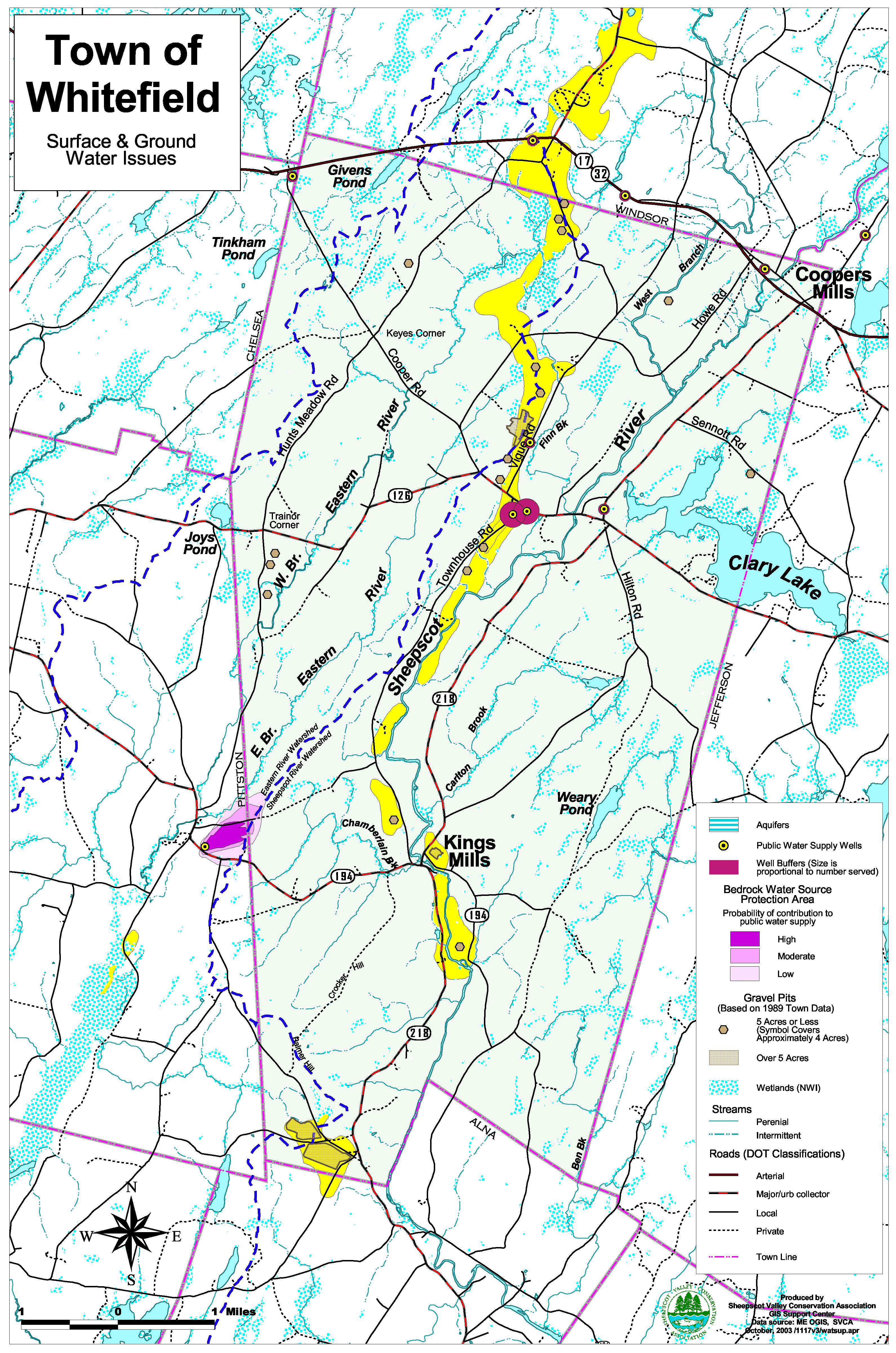
WATER SYSTEMS
(LOW
) (HIGH)
(PDF)
(LOW ) (HIGH)
(PDF)
(LOW ) (HIGH)


WETLANDS AND DEER YARDS
EXEMPLARY COMMUNITIES PROPOSED BUSINESS & VILLAGE
(LOW )
(HIGH)
(PDF) (LOW ) (HIGH)
(PDF) (LOW ) (HIGH)


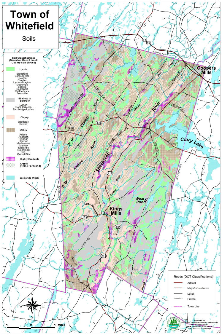
LANDCOVER E-911 ROADS SHORELAND ZONES SOILS
(LOW ) (HIGH) (LOW ) (HIGH) (LOW ) (HIGH) (LOW ) (HIGH)